Estancias, gauchos and the epic, empty road. A self-drive through Patagonia is a great way to get a sense of rural Argentina, says Jonathan.
Much of this journey would be along Ruta 40, a road that runs the length of the country; would this be a Route 66 for South America?
 The vast emptiness of Patagonia is a place that has always had a hold over me, so when the opportunity came up to pioneer some Audley self-drive itineraries on the Ruta 40, I jumped at it. Along for the drive was Carolyn, Audley's Programme Manager for Latin America, in the role of navigator, translator, note-taker and restaurant-stop planner.
The day had started well. The sky was blue, it was gloriously windy in a way that only Patagonia can be, we had a morning visit to the Cave of Hands, an archaeological site that I had wanted to visit for over a decade, and all was well with the world. Fourteen hours later we spluttered out of the wilderness and into the tiny town of El Chaltén after a fraught last 100 kilometres in which the fuel gauge had settled below empty.
Tip 1 — for Patagonia self-drivers — always, always fill up with petrol in every single town that has a fuel station
Hitting the road
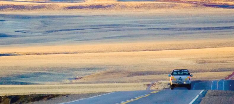
Much of this journey would be along the famed Ruta 40, a road that runs the length of the country; would this be a Route 66 or Stuart Highway for South America? We believed it would offer some wonderful new opportunities for our clients who like to be a little more independent, and also a good value option for trips to Argentina.
Starting out from Esquel on a gravel road, we set the satnav for the small town of Perito Moreno, some 550 km (341 miles) away. The automated voice said 'continue straight for 215 miles until the next turn.' Let the road trip into the unknown begin.
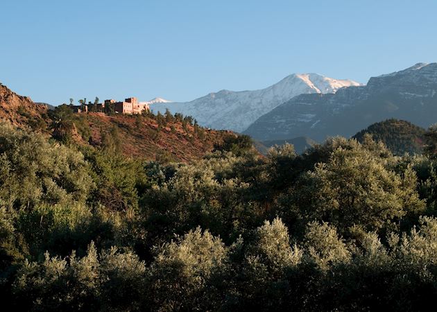
The day before had been a great journey south from Bariloche, through a populated area full of colourful autumnal forests, but this was a different scale of journey. Leaving the hills and trees behind we were now heading out on to the Patagonian steppe for real. Ruta 40 was taking us through scenery that was constantly changing and morphing as we drove. Condors floated overhead, guanacos grazed in small herds, gauchos were herding their sheep across vast estancias.
Road signs of any description were a novelty, so when we saw a sign for a new museum we ducked off the main road and found a delightfully informative museum about the region’s history, with a reconstructed tea room from the days when the estancia that houses the museum was a refreshment pit stop for travellers on horseback.
Tip 2 — take a random detour if a sign tickles your fancy — and let us know what you find
Off the scale
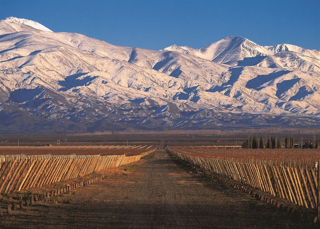
It appears flat and featureless but that is nothing more than an illusion caused by its sheer scale. This is a land shaped by ice, fire and wind with hidden valleys and huge plateau that slowly rise up into the Andes. It was in one of these valleys that we found the small town of Rio Mayo.
We knew that there was an estancia with lodging called Estancia Don Jose somewhere near the town that we wanted to check out. We found it halfway along a dry river bed to the south of the town and we were met by a bemused looking caretaker in immaculate gaucho wear, who explained the estancia had just closed for winter. Luis had obviously not seen anyone without four legs for a while and was quite keen for a chat, so this left Carolyn to fill the role of translator and me to take pictures of this great little property.
Tip 3 — the restaurant in Rio Mayo was much better than we would have expected from a tiny town with just one paved road, so don’t pre-judge any restaurant you may come across on your trip

Into Santa Cruz
Up to that point we were in the province of Chubut, but soon after leaving Rio Mayo we entered the province of Santa Cruz. This was indicated by both a road sign and, more interestingly, by the fact that we suddenly joined a tarmac road, and would more or less remain on tarmac for the rest of the trip.
We found ourselves in the tourist information office in the town of Perito Moreno (not to be confused with the glacier of the same name) just before it closed, having the following conversation:
Carolyn: “Please could you recommend a hotel here for one night?”
Señora in office: “We recommend going to Los Antiguos.” (that was another town 60 km away and off our route.)
Carolyn: “We don’t really want to drive any more, so can you recommend somewhere here in Perito Moreno?”
Señora: “No, stay in Los Antiguos, here is the address of their tourist office.”
Carolyn: “So your job here at the Perito Moreno tourist office is to advise people to stay somewhere else?”
Señora: “Yes, that is what we recommend.”
Tip 4 — listen to the locals, they are usually right
Hands together
Los Antiguos was a handsome little place on the shores of a lake, with great views and a compact town centre with good restaurants and bars. We found a place to stay, and our day was done.
We had always known that heading to Patagonia in late autumn would be tempting the weather but up until this point we had been revelling in clear skies and amazing colours, and so it was when we set off into the wilderness once more. It was another beautiful day on the empty open road, with a visit to the Cave of Hands, a stunningly located site of prehistoric art. We were the only non-Argentine visitors, and the locals welcomed us with — literally — open arms and disbelief that we should find ourselves there. After this stop, we had a small caffeine emergency before continuing on our journey.
Tip 5 — treat caffeine stops like fuel stops, fill up whenever the opportunity arises
Estancia Monte Dinero is home to 18,000 sheep, an enormous Magellanic penguin colony, the start of Ruta 40 and the lighthouse at Cabo Virgenes.
The search for fuel
We hadn’t planned to be going all the way to El Chaltén in one day — 640 km (397 miles) — but, well, we realised mid-afternoon that there was nowhere else to stay, as the estancias that we knew dotted Ruta 40 all seemed to be shut as it was out of season, and the ‘towns’ were just dusty outposts. No problem, we thought, we’ll keep going, as this would mean we’d have three nights and two full days of trekking stretched out in front of us.
A dampener was put on this plan by the fact that as we were about to begin our trek, it started raining. And in between the rain were bouts of snow and hail. But in the periods the weather was too bad to hike we decided to write up our notes and debate the ‘ideal itinerary’ for clients, as it had become very clear by this stage that we were not necessarily doing the exact trip we would recommend to you.
Before we could leave El Chaltén there was the small matter of finding fuel. On our arrival we had been reliably informed that there was no fuel station, but told not to panic as there was a man who 'could give us some'. It did at least turn out to be a real (although antique) pump. Two minutes later I was standing in the rain, feeling very English as the very nice man next to me filled my tank to the brim.
Turning east was always going to be a bit of a change, as the mountains move from the right-hand side to the rear-view mirror and then disappear over the horizon. It is amazing to think that Argentina has some 2,500 km (1,553 miles) of coastline, but not much is ever visited by travellers, but we were now headed to ‘the bit that sticks out at the bottom’ by the Beagle Channel.
The trusty Toyota Hilux soon got us to Rio Gallegos, a city that loomed out of the Patagonian Desert in the type of sprawl that only a port-cum-oil town can, with the traffic (and other people!) shocking our system. But it was not for long, as the road took us straight through and out the other side, and the very last 100 km (62 miles) of Ruta 40 returned to gravel.
Final tip: pay attention when driving on gravel roads — best to only allow `sensible' drivers (e.g. not Carolyn) to take to the wheel as I discovered!
Finishing in style
We passed fuel processing plants in the middle of vast estancias, which really brought this landscape into the modern world, and as the sunset turned red and orange in the mirrors, we reached Estancia Monte Dinero and the end of the road.
At the end of any day there was little more than ‘dinner’ on the mind of my travelling companion, and she was not to be disappointed tonight as the most incredible Patagonian lamb found its way to the table accompanied by fresh vegetables from the garden and unquestionably the best dauphinoise potatoes ever.
This little (by Argentine standards) outpost sits along the barbed wire fence that denotes the border of Chile and Argentina. The farm is 4th generation Irish-Argentine, and is home to over 18,000 sheep, an enormous Magellanic penguin colony, the start of Ruta 40 and the lighthouse at Cabo Virgenes. Between us we reckoned to have visited some 30 different estancias across all of Argentina yet nothing had come close to Monte Dinero.
Certainly we had seen more luxurious places, but Monte Dinero operates to its own rhythm. The gauchos get on with their sheep herding, producing fine merino wool. The chefs provide simple but incredible food. Everyone is happy for you to watch (or partake in) any estancia activities. The hosts want to show you around the property but won’t hassle you to do so.
They may even be able to arrange a border crossing between Argentina and Chile so you can visit to the Chilean lighthouse that lies just round the headland from Cabo Virgenes, to observe the monitoring of the traffic in the Beagle Channel.
Estancia Monte Dinero is a slice of real Patagonia like no other we know. A must-stay place, whether you are self-driving or otherwise. It was the kind of find that makes this job so worthwhile.
Was this useful?