
By Audley New Zealand specialist John
New Zealand is like one long national park, an ancient landmass with a geologically youthful landscape that tilts giddily from one extreme to another.
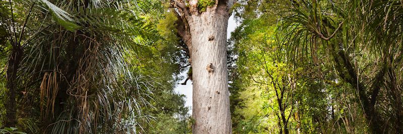
You’ll find volcanic terrain and crater lakes the shade of the country’s malachite greenstone. Forests of coniferous kauri trees and subtropical plants. Fertile plains, vineyards and tussock grassland giving way to alpine regions and weathered coastline. The variety truly is staggering, and if you’re driving, you can get to the more out-of-the-way spots. Roads are open and easy to navigate, and signage is excellent.
Driving also lets you follow your nose. One time, I heard about this great little pub in Havelock, Marlborough — the Captain’s Daughter — that apparently served superb green-lipped mussels, and fish and chips. So I made an impulsive detour to try them for myself.
Touring New Zealand by car — three routes to try
Route 1 (South Island): Franz Josef Glacier to Queenstown via the Haast Pass
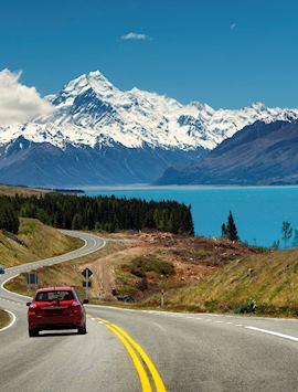
If I had to choose just one drive out of the whole of New Zealand, this would be it. The drive is straightforward and smooth; the scenery wild and untamed. The whole journey takes around five hours, although you may wish to go slower, taking multiple stops to explore the landscapes.
Here, you’re in a region where a temperate tropic climate meets the cold air sweeping off the ice fields of the Southern Alps. As you drive south, the snow-capped peaks of the Alps on your left and the Tasman Sea to your right, you’ll see the steam rolling off the mountainsides, forming low-lying bands of cloud.
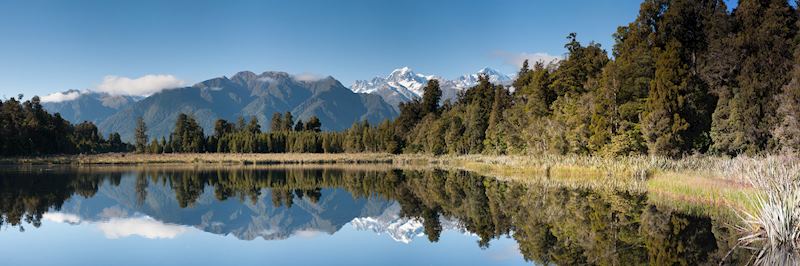
At Franz Josef Village, a settlement that has sprung up around the glacier, you have the unusual juxtaposition of lowland podocarp rainforest clustering close to the raw ice of the glacier’s terminal face. Heading south, you pass Lake Matheson; on a still day, its mirror-like waters reflect the backdrop of Aoraki/Mount Cook with piercing clarity.
After driving through the even smaller village of Fox Glacier, you head into more forested valleys and cross rivers. Beyond Haast, a tiny town on a river mouth, civilization begins to peter out. There’s a frontier feel to it all as you turn inland, cross the boulder-ridden gorge of the Haast River and cut through the Haast Pass.
When I drive through the pass, I just want to stop every five minutes as I try to take it all in: waterfalls, white water rivers, alpine valleys, untouched beech forest, then the Minarets mountain rising up behind the cyan waters of Lake Hawea and the darker cobalt of Lake Wanaka.
You can snake through the Kawarau Gorge to continue to Queenstown. Alternatively, drive there via Cardrona, a 19th-century gold rush township, to enjoy a view of the Remarkables mountain range before descending to Queenstown itself.
What to see and do en route
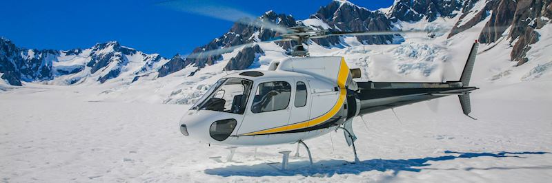
If you don’t mind the helicopter journey there and back and are moderately fit, I think the best way to experience the west coast glaciers is through a heli-hike.
I recommend heli-hiking on Franz Josef Glacier. I remember our guide carving out a fresh route as we went, leading our small group through the immense crevasses fissuring this slow-moving body of ice. We entered tunnels and caves that glowed a bright mint blue. Sometimes, it felt as if we were journeying deep into the creaking mass. At other times, we walked on its surface and stared up at the formidable rock face on either side. At the end of the hike, while we were waiting for the helicopter to pick us up, it began to snow. An impromptu snowball fight broke out.
You can also take the two-hour unguided walk up the Waiho River from Franz Josef Village to reach that glacier’s terminal face. You look across a field of boulders, shingle and orphaned lumps of ice to the glacier’s blue and white snout streaked with moraine debris.
The route from Franz Josef to Queenstown is typical of many great drives in New Zealand in that it’s surrounded by lots of short hiking trails. New Zealand’s Department of Conservation does a great job with these — they’re well marked and you’re told how long one takes, so you’re able to budget your time. It’s easy to stop for an hour or so and stretch your legs.
Near the Haast Pass you can take a short forest track to see the Thunder Creek Falls, a thin but powerful cataract that gushes down an exposed rock wall into the jade-hued Haast River from a small chink 30 m (98 ft) high.
Where to stay
.jpg?q=79&w=800&h=266)
Ending your journey in Queenstown, I’d stay in Hidden Lodge, a B&B that’s 7 to 8 minutes’ drive from the town. The payoff for being located a little further out is an uninterrupted view over Lake Wakatipu from the property’s hot tub, as well as owner Claudia's delicious home-cooked breakfasts using free-range pork and salmon.
A short bicycle ride from the heart of Queenstown is the Rees Apartment Hotel, whose balconies all overlook the lake and the Remarkables mountain range.
Route 2 (North Island): Paihia to Auckland via Whangarei and Warkworth
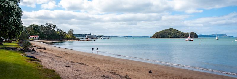
This route takes you from the Bay of Islands’ main entry point, the coastal town of Paihia, to the country’s largest and most cosmopolitan city. At a leisurely pace, including stop-offs, the whole drive should take around five to six hours.
What I like about driving in this area is how markedly different its topography is to the rest of the country. It’s a more unassuming, relatively flat area of forest, farmland, bush and orchards. Yes, it’s a far cry from the drama of the Southern Alps, or the volcano-scorched territory of the North Island’s Tongariro National Park. It generally receives fewer overseas visitors, but I love winding my way down this coast, stopping off for shoreline walks and pottering around the small Pacific-facing towns.
What to see and do en route
Leaving Paihia, head south to Whangarei, a town wedged between hills and the ocean. It has a quaintly colonial Town Basin (marina) where you can grab lunch. If you make a detour into its suburb of Tikipunga, you’re rewarded with a view of the sheet-like Whangarei Falls, which drop into a sheltered green pool surrounded by banks of wildflowers.
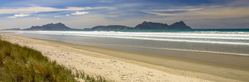
Then I’d stop at Waipu, just off State Highway 1, 25 minutes south of Whangarei. The town has a walkway that runs right along its shoreline, or you can take the one-and-a-half-hour round track to the Waipu Caves, a completely undeveloped limestone karst complex.
The caves are free to visit. Squeeze past the sometimes dense clusters of stalactites and stalagmites and make your way over slippery rocks to the third chamber to view its resident glowworms.
Continue to Warkworth, a town that sits by what looks like a river but is actually a tidal estuary, with several good hikes running alongside it. The town has many cafés, galleries, craft shops and antique shops. A 15-minute walk from the main road are the Pohuehue Falls. Hidden away in a ferny area of bush, they pour down an uneven mossy rock wall.
Where to stay
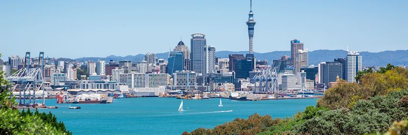
Bookend your drive with two great properties. At Paihia, you can stay in Allegra House — a relaxed, welcoming guesthouse set high on a hill overlooking the bay, with steps leading all the way down to the waterfront. If you’re continuing on to Auckland, I suggest finishing your road trip at the Hotel DeBrett. It’s actually Auckland’s oldest hotel, but you wouldn’t necessarily know it: it’s a boutique place tucked away down a side street in the heart of the city, and its rooms are decorated with bright, fun artwork and furnishings.
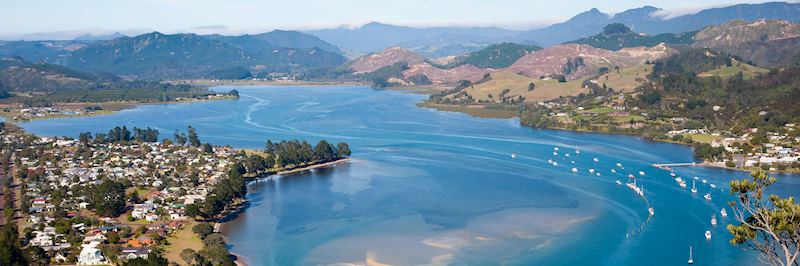
Route 3 (North Island): Coromandel Peninsula from Thames to the east coast
Admittedly, this isn’t as epic a route as the other two, but it carries a hefty reward. Lasting around three hours, the drive starts in Thames, a quiet, arty town that once thrummed with machinery pounding quartz in its 1870s mining heyday.
From here you take the road north that hugs the Firth of Thames, an area of intertidal mud flats that’s a haven for wading birds. Keep following the coastal road all the way to Coromandel Town. You then head east across the peninsula and start to climb up a series of switchbacks, driving through the thick bushland and kauri woodland of the Coromandel Forest Park.
You climb higher still and glimpse the Pinnacles, a ridge of exposed rock that resembles a series of knuckles. Then, as you clear the forest and emerge on the east coast near the estuary at Tairua, it’s almost as if someone has pulled back a veil. You see the ocean suddenly open out before you, with beaches and towns huddled directly below.
What to see and do en route
Before you reach Coromandel Town (and if you’re feeling peckish), I recommend stopping off at the Coromandel Mussel Kitchen to sample their fare, farmed out in the bay.
If you’re a train enthusiast, you could make a detour to the Driving Creek Railway, where you can take an hour’s train ride through native kauri forest on a narrow gauge mountain railway. The track spirals and traverses tunnels and viaducts as it climbs to the top of a hill, giving you views over the whole peninsula. For an even quirkier detour, consider taking the 309 road to visit local farmer Stuart and his (paradoxically tame) wild pigs.
The Coromandel Forest Park is criss-crossed with hiking trails looping around the bush as well as pleasant picnic spots. There’s a three-hour hike to the base of the Pinnacles (and an even longer route to the summit) that uses an old logging track, taking you across swing bridges and through groves of great-girthed rata trees. The streams here are good for trout fishing, and you may spot gemstones in their waters.
Once you arrive on the east coast, there’s a lot to enjoy, not least the miles of open beach. There’s also a craft trail that takes you around the many artists’ studios that populate the peninsula: potters, painters, weavers, and carvers of bone and greenstone in Māori styles.
Where to stay
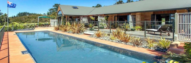
I highly recommend Colleith Lodge in Tairua, a three-room property surrounded by native bushland. Hosts Wayne and Helen are gracious and generous with their time, and they have tons of stories about the local area.
Best time to visit New Zealand for a driving vacation
Personally, I think October and late March/early April are the best times to drive in New Zealand. The climate is comfortable: in spring (October), the countryside will still retain the green lushness of summer, while in late March, there’s some residual warmth from the sun but the leaves are just beginning to turn.
There are also far fewer visitors at this time of year. This is advantageous when it comes to touring New Zealand by car: you’re less likely to be stuck behind a slow-going vehicle on single-track roads.
Tips for driving in New Zealand — do's and don'ts
- Do budget for more time than you think you’ll need for any drive. You’re definitely going to want to stop and explore, or admire a view.
- Do travel with someone else who’s happy to drive, if you can, so you can alternate between who’s looking out of the window and who’s concentrating on the road.
- Do expect sheep to wander onto the road; I’ve also had to stop for cows in the past.
- Don’t drive anywhere near Auckland around 3pm — this is rush hour.
- Don’t be surprised if you intend to turn on your directional and your windscreen wiper flicks on instead — the two are reversed in many New Zealand cars.
New Zealand drives on the left. Open roads and single lanes make driving ‘user-friendly’, even if you’re used to driving on the right-hand side of the road.
Start planning your self-drive trip to New Zealand
Start thinking about your experience. These itineraries are simply suggestions for how you could enjoy some of the same experiences as our specialists. They're just for inspiration, because your trip will be created around your particular tastes.
View All Tours in New ZealandPlan your trip
Tell us about your plans and one of our specialists will plan a unique trip for you...
Make an inquiryRequest our brochure, The World Your Way

Order your digital copy via email.
Request a brochure